mindset.
The one about choosing how we see the world
Gall-Peters Projection Map – An Equal Area World Map
Credit: Arno Peters PhD (1916-2002) and James Gall (1808-1895)
Summary:
All maps are not equal, but they are all political. paul chooses to favour the Gall-Peters Projection World Map because, to him, it offers a fairer representation of the relative size of each continent and country. In paul’s view the (Mercator Projection) map he was introduced to as a primary school student has a bias toward Europe and North America, representing them larger in size than they actually are. paul, previously assumed these representations of size were correct, and unthinkingly associated this with power and global importance. Regardless of wether it was a conscious Euro-centric bias of the 1980’s education system/teachers or an unconscious/unthinking act, paul now understands that map makers (cartographers) choose how to represent the relative size/importance of each country, so he chooses to be mindful of it.
Real world application:
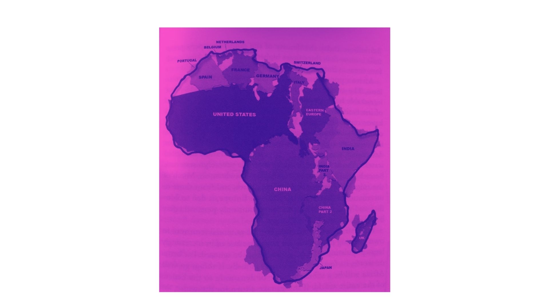
If the Gall-Peters Projection Map is consciously chosen to study the Earth, one can see how large Africa is relative to continents and countries in the northern hemisphere. See the graphic below that squeezes China, the United States of America, India, and a handful of European nations into the actual land mass of Africa [Credit: Guillen, M. (2020) 2030: How today’s biggest trends will collide and reshape the future of everything. (p. 41) Gloucestershire, UK: Flint.]
Concept detail
The process of visually representing a three dimensional object, like Earth, in a two dimensional format, as a map, usually leads to some distortion of the relative sizes of regions on the map. One of the most popular maps of Earth, the Mercator Projection, causes the developed regions of Europe and North America to appear very large relative to the less developed regions of Africa and South America, which are actually significantly larger. The Gall-Peters Projection (and others) seeks to address this by representing regions with (near) correct area, effectively removing the Euro-centric bias.